
 Mass on Sunday mornings can lead to many different things. This particular Sunday we were invited to share breakfast with the parishioners. We not only learned about their parish and its rich history we also learned of an international boundary within the continental United States – the last such one known.
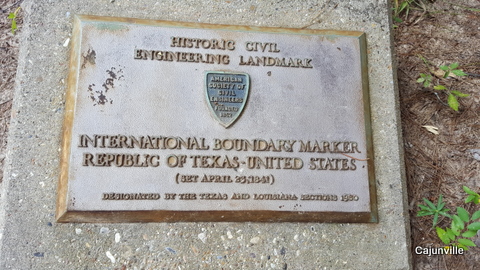
As we all know and our Texas friends won’t let us forget, there was, and some say there still is, a Republic of Texas. One of its borders with the United States was the Sabine River which borders Louisiana and Texas. The area west and east of the Sabine River was considered “No Man’s Land” and referred to as the “Neutral Ground”. Along with these issues, there were also border disputes. Once the Republic of Texas was established, both Texas and the United States wanted the boundary disputes settled. On May 20, 1840 a survey crew began at the mouth of the Sabine River (at the Gulf of Mexico) traveling north until they reached the Red River. The first post of 36’ was placed at the Gulf of Mexico on an earthen mound. From there 8’ posts were placed denoting miles from the 32nd parallel. From the parallel the crew headed due north. They reached the Red River in June 1841, taking a year to complete the survey.
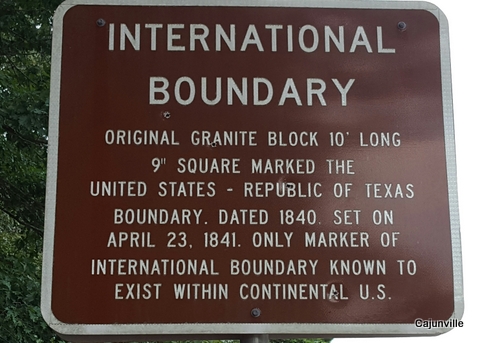
Marker Sign
Over time the mile posts have been lost to the Sabine River and erosion. But the one post marking the 32nd parallel is still proudly standing between Logansport, LA and Deadwood, TX. This granite marker is engraved on three sides – two sides mark the international boundary between the United States and the Republic of Texas and the third side marks the north-south meridian. The block is 10’ long and 9” square.

Denoting 32 Parallel
The marker stands just off the highway on Texas FM31 just over the Louisiana border, LA Hwy 765. There is a small parking lot which makes it easy to stop and experience a piece of history. The area around is wooded with no settlement. It is easy to imagine what it was like over 200 years ago crossing from the Republic of Texas into Louisiana. We realized how difficult travel was both in safety and comfort.
Logansport is not only close to the International Marker but also home to the grave of (Louis) Moses Rose. He is said to be the only survivor of the Alamo. Fact or lore, no one is sure – he decided not to stay and fled making his way to what was then Logan’s Ferry. He was befriended by the Ferguson’s and lived out his life on their farm and is buried in the family cemetery. His gravesite is a historical site due to the foresight of the DeSoto Parish Historical Society. At the time few grave markers were left in the cemetery. Realizing the historical significance of Moses Rose’s history, a new granite marker was placed on his grave. The marker is inscribed, “Soldier of the Alamo”.
An afternoon drive in the country revealed more Texas history than we realized Louisiana was home to.
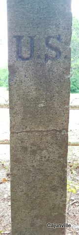
United States
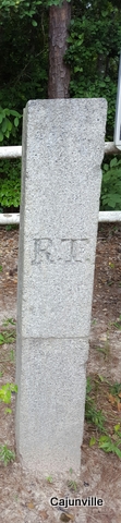
Republic of Texas
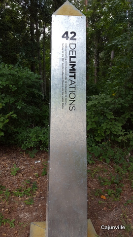
New Boundary Marker
Ground Historical Marker
